Construction site monitoring
Regular site surveying and change tracking web service
We offer
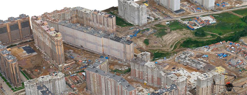
- Construction site, dumps, excavations and piles 3D modelling
Horizontal and vertical accuracy of the model - 5 cm. Digital terrain model and a high resolution orthomosaic produced along with the 3D model. - Volume calculation for piles, excavations and dumps
Technology allows getting the accurate volume calculations just in few hours after the flight. Obtained data could be then published in the WEB viewing service. - Volume difference calculation
During periodic monitoring we can calculate volume difference of any pile or ditch in "before/after" mode for each the specified time period. - Publishing data online
In a change tracking web service. Data displayed as linked panoramas or 3D model with the highlighted volume changes for the selected time period. - Real-time aerial monitoring
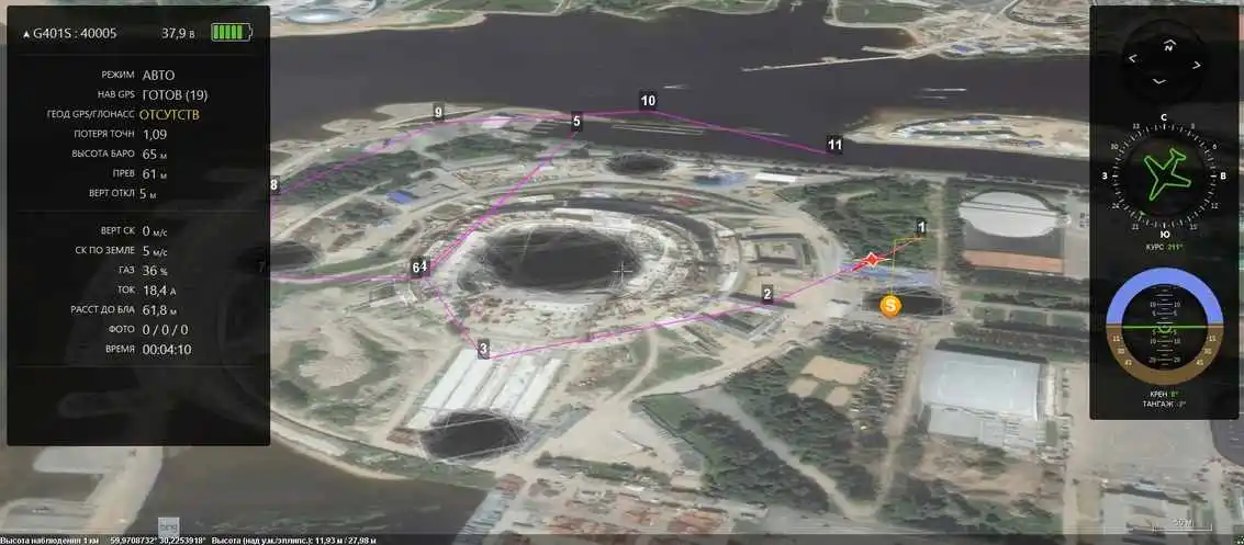
With image transmission in HD quality.
How it works. Stadium construction monitoring.
Monitoring includes
1. Capturing 360 degree aerial panoramas from predefined points at a specified frequency*
2. Data processing and production of panoramas
*(daily, weekly, monthly, quarterly, etc.)

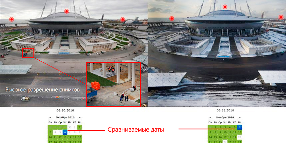
3. Publishing data online at a custom web service for viewing and comparing panoramas
The technology is designed specifically for construction site dynamics monitoring and overall object control by comparing panoramas for the selected dates. Panning and zooming is synced for the displayed panoramas.

4. 3D model production

5. Orthomosaic and DEM production

These products allow
- Extraction of the elevation points in XYZ
- Measuring of excavation and pile volumes
- Measuring and controlling volumes of materials
- Creation of a photo-realistic BIM object model
- Measuring of the structures "as-built"
- Comparing construction implementation with the project
- Tracking construction progress
We use professional industrial drones
The surveying is performed using industrial UAV in automatic mode under operator supervision. High quality of the obtained 3D model is achieved by using professional cameras (Sony RX-1) and precise synchronization of the shutter with GNSS receiver.

The technology is based on the creation of a high-res 3D model using UAV survey data and accurate GNSS measurements. Digital surface model built using unmanned aerial technologies is geometrically more accurate than one obtained using traditional on-the-ground methods.
Cost saving is achieved due to the high speed of data acquisition with the accuracy close to LiDar scanning. The costs of both field and desk work a reduced and the human factor is eliminated from calculations.